Trail Walking La Châtelaine - Cirque du Fer à Cheval - cascade des Tufs - Arbois - Photo

Cirque du Fer à Cheval - cascade des Tufs - Arbois

 Bart2015
Bart2015

User

© OpenStreetMap contributors
Length
Length
18.2 km
Max alt
Max alt
584 m
Uphill gradient
Uphill gradient
471 m
Km-Effort
Km-Effort  
24 km
Min alt
Min alt
290 m
Downhill gradient
Downhill gradient
471 m
Boucle
Boucle
Yes
Creation date :
2023-08-10 08:23:57.139
Updated on :
2023-08-10 20:57:03.578

(0 Reviews)

Walking
Walking
5h34
Difficulty : Very difficult

Scan this QR Code to open this trail in the SityTrail application

FREE GPS app for hiking

Logo SityTrail SityTrail

IGN / Geographical institutes

Download SityTrail from the App Store Download SityTrail from Google Play

Logo SityTrail SityTrail World

The world is yours!

Download SityTrail from the App Store Download SityTrail from Google Play Download SityTrail on Huawei AppGallery

About

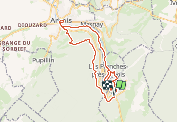
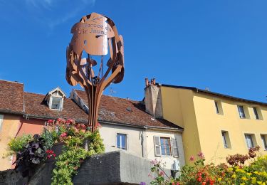
Trail Walking of 18.2 km to be discovered at Bourgogne-Franche-Comté, Jura, La Châtelaine. This trail is proposed by Bart2015.

Description

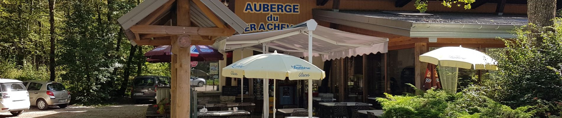
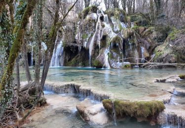
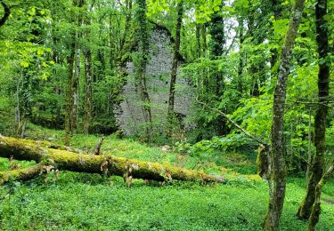
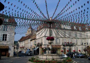
Belle rando depuis l'Auberge du Belvédère du Fer à Cheval. Elle longe le Cirque du même nom et mène dans un premier à la Cascade des Tufs magnifique sous ses versants moussus. Retour vers Arbois par un sentier qui longe la Cuisance puis par une route. Petite surprise un peu avant le village, un petit arrêt s'impose ... Petit tour dans Arbois qui mérite le détour, pourquoi pas pause au bistrot La Tournelle ouvert en juillet-août et tenu par les vignerons de la Tournelle ... Retour un peu physique en empruntant un magnifique petit sentier menant à une chapelle puis à l'allée du Roi de Rome avant de rejoindre le Belvédère du Fer à Cheval.
Bonne rando ...
Variante possible en démarrant d'Arbois, pour démarrer par la montée ...

Elevation profile

Photos

36 photos in total. Please click on a photo to see them all in the gallery.

Positioning

Country:
France
Region :
Bourgogne-Franche-Comté
Department/Province :
Jura
Municipality :
La Châtelaine
Location:
Unknown
Start:(UTM)
714144 ; 5194182 (31T) N.

Trails nearby

Trail Walking Arbois - Arbois Église Saint Just / Chapelle Notre Dame de l'Ermitage/ Cascade des Tufs/ Les Planches près d'Arbois / Cirque du Fer à Cheval / Belvédère de la Châtelaine/ La Roche du Feu/ Meslay/ Arbois  - Photo
Walking
thierry cachot

Walking

Difficult
(1)
Arbois, Bourgogne-Franche-Comté, Jura, France
23 km | 35 km-effort
6h 42min
Yes
Trail Walking Arbois - Arbois Pupillin Arbois - Photo
Walking
thierry cachot

Walking

Difficult
(1)
Arbois, Bourgogne-Franche-Comté, Jura, France
16.2 km | 22 km-effort
5h 0min
Yes
Trail Walking Arbois - Arbois Belvédère du Fer à Cheval Belvédère Châtelaine Cascade des Tufs Planches près d'Arbois La Roche du Feu Mesnay Arbois - Photo
Walking
thierry cachot

Walking

Difficult
(1)
Arbois, Bourgogne-Franche-Comté, Jura, France
23 km | 34 km-effort
6h 36min
Yes
Trail Walking Arbois - Arbois Reculée des Planches - Photo
Walking
GUIDE
thonyc

Walking

Medium
Arbois, Bourgogne-Franche-Comté, Jura, France
12.2 km | 16 km-effort
4h 10min
No
Trail Walking La Châtelaine - les planches d'Arbois restaurant le fer à cheval - Photo
Walking
grasgilbert

Walking

Difficult
La Châtelaine, Bourgogne-Franche-Comté, Jura, France
10.7 km | 15.7 km-effort
3h 33min
Yes
Trail Walking Les Planches-près-Arbois - la reculée des planches - Photo
Walking
loca.yves

Walking

Medium
Les Planches-près-Arbois, Bourgogne-Franche-Comté, Jura, France
15.7 km | 22 km-effort
5h 35min
Yes
Trail Horseback riding Les Planches-près-Arbois - EQU-INTEGRALE-2021 - Photo
Horseback riding
aeldin

Horseback riding

Very difficult
(1)
Les Planches-près-Arbois, Bourgogne-Franche-Comté, Jura, France
35 km | 50 km-effort
6h 35min
No
Trail On foot Arbois - Entre Bois et Vignes - Photo
On foot
PRO

On foot

Easy
Arbois, Bourgogne-Franche-Comté, Jura, France
9.2 km | 13.1 km-effort
2h 58min
Yes
Trail Walking Les Planches-près-Arbois - Les bèlvédères de la reculée des Planches - Photo
Walking
viam19

Walking

Difficult
Les Planches-près-Arbois, Bourgogne-Franche-Comté, Jura, France
13 km | 18.5 km-effort
4h 40min
No


Close
My subscriptions